Local Rides
Local Rides In Durango, CO
Maps and more trail info can be found at
![]()
Durango Trails - www.durangotrails.org
Pedal Durango - www.pedaldurango.com
Gravel Rides - www.gravelmap.com
MTB Project - www.mtbproject.com
Durango trails are among the best in the world. You can access hundreds of miles of perfect single track right from town, no vehicle required. You can be on a trail in minutes from downtown and ride single track for hours without riding the same trail twice.
We know it's easy to get turned around while you are out enjoying our trails. And we think it's a great idea to carry a map, just in case. Search and Rescue can cost $$$ compared to a $10 map and it's a great backup if your phone looses signal or battery.
Plus, you can roll out your map while you are enjoying a post-ride drink with your friends and plan the next day's adventure.
Just an FYI, you can purchase a Colorado Search and Rescue card for $3.00/year. Accidents do happen and you can avoid lofty rescue fees if you are a card carrying member.
Mountain Bike Rides
Horse Gulch Trails
The trail head starts at 8th Avenue and 3rd Street, with a small parking lot at the beginning of the trail. You start by climbing up a rocky 4-wheel drive trail that eventually opens up to rolling meadows. Once you reach the meadows, take a moment to look at the map posted at the main intersection. Turning right will lead you into the meadows with multiple beginner and intermediate trails. Just follow the signs. If decide to turn left, the trail gets technical and steeper with lots of challenging rocky climbs and descents. You can also continue straight and try out the new Sugar trail that climbs up to more technical trails and stunning views of the Animas River valley.
Durango Mesa Park
The newest addition to the collection of trails in Durango! The system is a collaboration between the City of Durango and the Durango Mesa Park Foundation as a teaser of what is to come in the future at the Durango Mesa Bike Park.
Overend Park
Overend Park can be accessed from multiple locations. The most popular route from downtown starts from 9th street, heading west and crossing Camino del Rio. Turn right on Roosa, and left on Avendia del Sol. Continue up onto Ella Vita and begin your climb to the right. At the top of Ella Vita trail, take the connector trail 8-Bells down to Perin's Gulch trail. Turn right and follow the Crestview (ditch) trail where it eventually becomes the Hidden Valley trail. You'll eventually climb up to a quick rest spot with a trail map. If you stay to your right you will get to the top of Star Wars: a swoopy and steep descent that drops you back into Perin's Gulch. If you go left, take a steep descent down Ned's trail. From the bottom of either trail, jus follow the trail maps to link you all the way to the Spirit Trail.
Colorado Trail – Hoffheins Connection
The Colorado Trail – Hoffheins Connection is a 20 mile single-track loop. Starting from Durango, head west on 25th Street, which becomes Junction Creek Road. After the paved section of the road ends, the Colorado Trail begins on the left side of the road. There is a parking area near the trailhead. Follow the trail along the creek, crossing over the bridge, until you reach Gudy’s Rest. Just 1/8 mile past Gudy’s Rest, take a left on the Hoffheins Connection trail. It’s all down hill to Lightner Creek Road. Follow Lightner Creek Road to Highway 160. Turn left, traveling east on Hwy 160 to get back to Durango.
Hermosa Creek Trail
The Hermosa Creek Trail was severely impacted by the 415 Fire in 2018. Many of the bridges were burned and erosion is an ongoing issue. Fortunately, our landscape is resilient and many users are enjoying the trail again, with modifications. Now, the recommended routes are out-and-back rides from the north or south trailheads. Please check the status of the trail before you ride. And be sure to bring plenty of water and extra food.
Road Rides
Baker’s Bridge
This 30-mile loop begins on North Main Avenue. Turn right on 32nd Street and ride until it ends at County Road 250, then turn left. County Road 250 will take you all the way to Baker’s Bridge, winding through the lush Animas Valley. Travel south over the bridge and straight to the intersection at Highway 550. Turn left on 550 and ride it past Honeyville to Hermosa where you get on County Road 203. The turn onto CR 203 is on the right, just past the railroad tracks and it will bring you back into Durango. This ride is also referred to as “The Full Valley Loop” by locals.
Trimble Loop
This is a shortened version of Baker’s Bridge, also referred to as “The Half Valley.” The total distance is about 15 miles. Begin at County Road 250, riding until you reach County Road 252. Turn left, riding past Dalton Ranch and across Highway 550. Turn left on County Road 203, which will take you back to Durango.
Elmore’s Loop
Elmore’s Loop starts on Historical 3rd Avenue. Head north on 3rd Avenue, which will become Florida Road (CR 240). Once on Florida Road, there will be a steady 6-mile climb that ends at Edgemont Ranch. About a mile after Edgemont Ranch, at the bottom of the descent, take a right on County Road 234, at the fire station. CR 234 connects with Highway 160 after about 12 miles. Head west on Highway 160 back to Durango. This loop is approximately 26 miles.
Durango/Bayfield Loop
This ride is about 45 miles long with a few steep climbs. The ride starts out the same as Elmore’s Loop on Florida Road (CR 240). Stay on CR 240 past the turn-off for Elmore’s Loop. When you reach the bridge, turn right, crossing the Florida River. Turn right on CR 501. Follow CR 501 to Highway 160. Head west on Highway 160 back to Durango.
Durango to Silverton
This one-way ride is 50 miles and roughly 6,000 feet of climbing. You will climb over Coal Bank Pass, at 10,660 feet and Molas Pass, at 10,900 feet. The trip begins on Main Avenue in Durango and becomes HWY 550. Your climb begins on HWY 550 just north of Hermosa. You climb past the Hermosa Cliffs and Purgatory Ski Resort. Then the fun begins as you pedal up and over Coal Bank and Molas Passes. The ride is easier traveling from Silverton to Durango, but be sure to warm up before you start because you begin on a mountain pass. Consider making arrangements to ride the train to Silverton, ride your bike to Durango.
Wildcat Canyon Loop
Wildcat Canyon Loop begins on Highway 160 W, with a long 10-mile climb then a short descent to Hesperus Store. Turn left at the store on Hwy 140. The road gradually declines for a few miles. Take your first paved left onto County Road 141, which is Wildcat Canyon Road and climbs up from a bridge. County Road 141 has gently rolling hills that will take you back to Hwy 160 just west of Durango. The loop is about 35 miles and can be ridden in either direction. Also, just a heads up, parts of the ride have no shoulder.
Contact us about local rides in Durango, CO
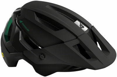
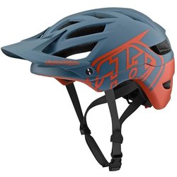
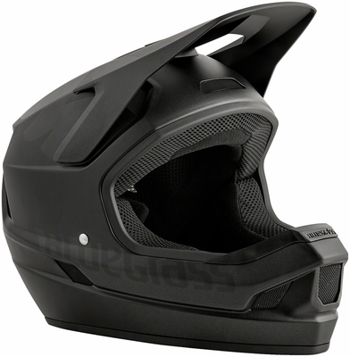
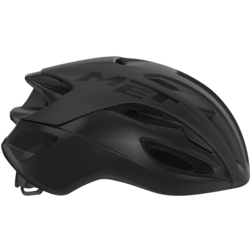
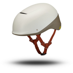
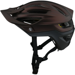
Stay Safe While You Ride
We have a great selection of children and adult cycling helmets to help protect your head while riding. We will properly fit your bike helmet to your head, so it is comfortable while offering better protection if an accident does happen.